As part of the Cultural Landscapes Program, I led geospatial documentation and archival research at Chamizal National Memorial to support a future National Register nomination. The project balanced long-term preservation goals with immediate park management needs—producing refined GIS data, tree inventories, and historical analysis that highlighted the significance of the site’s designed landscape.
National Register Nomination Support
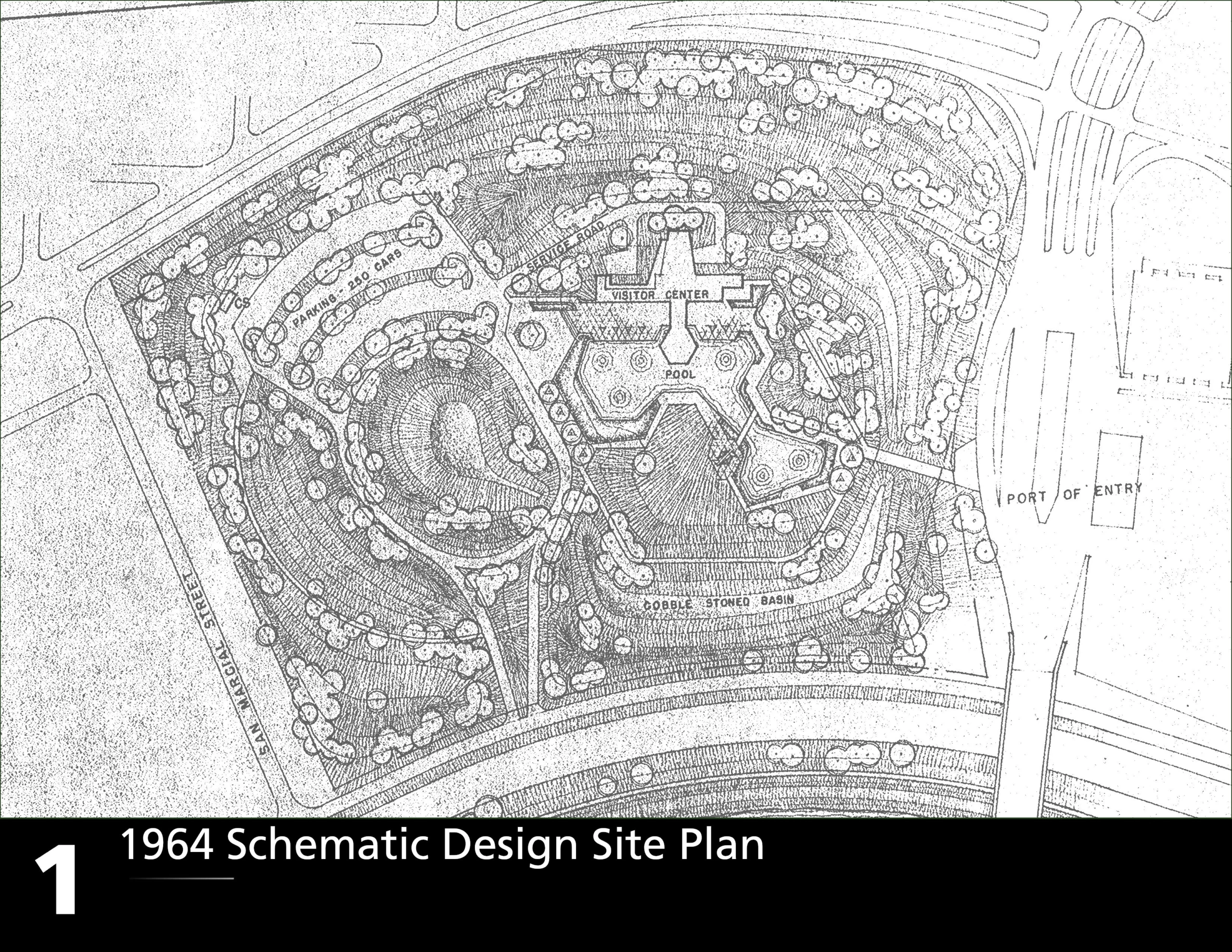
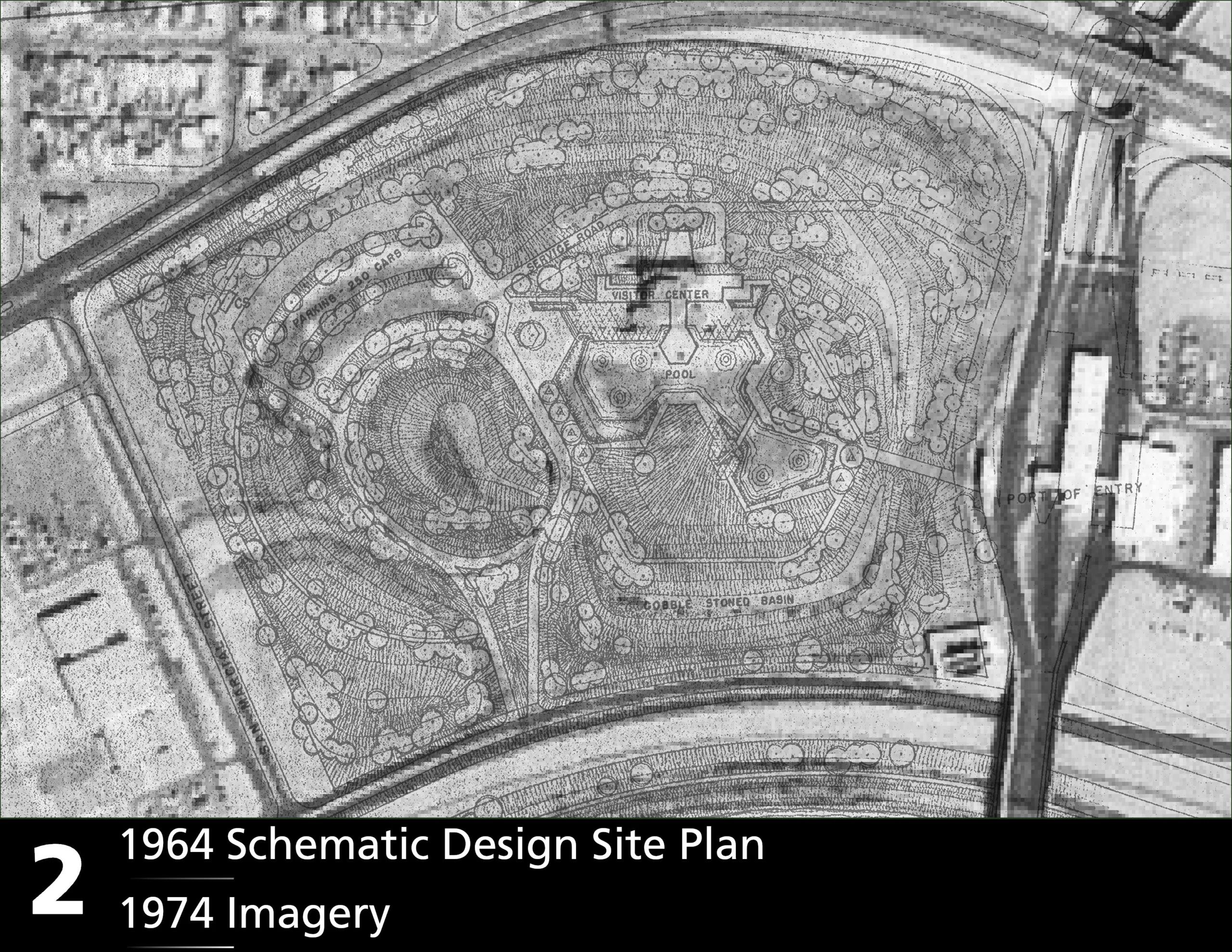
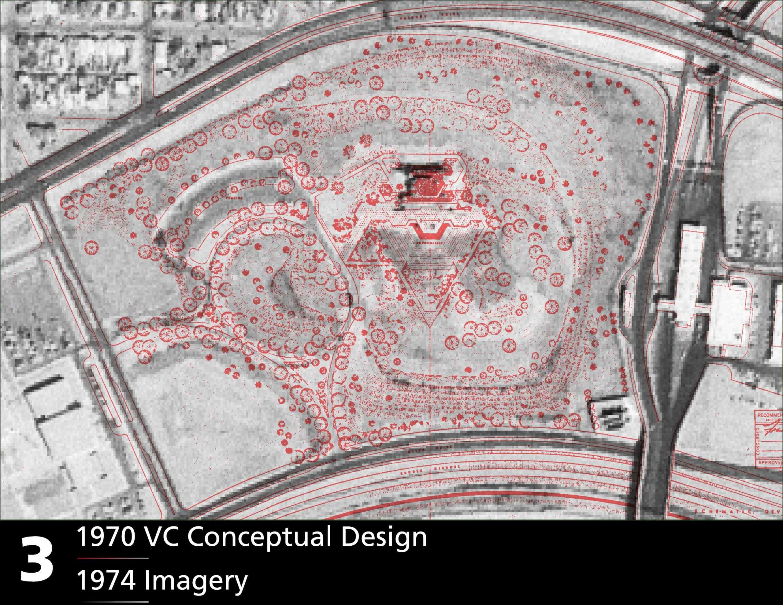
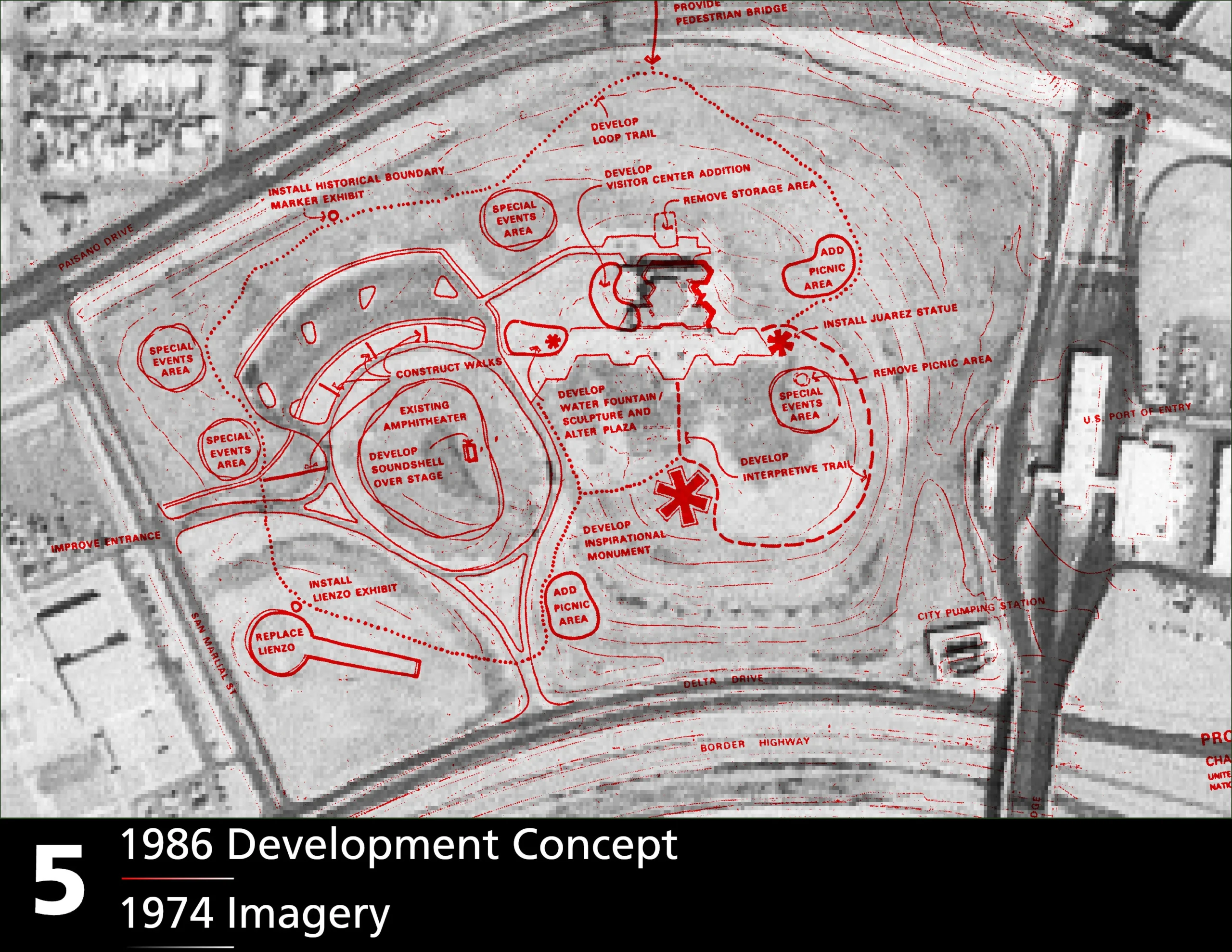
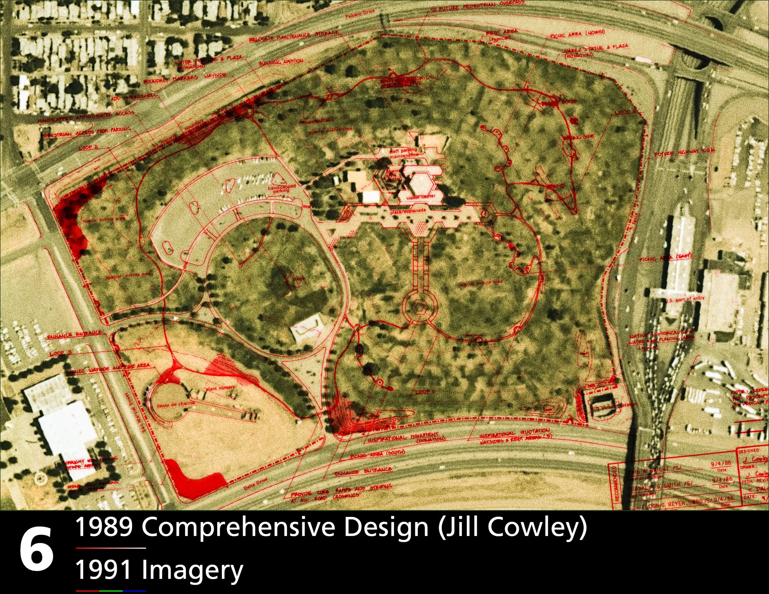
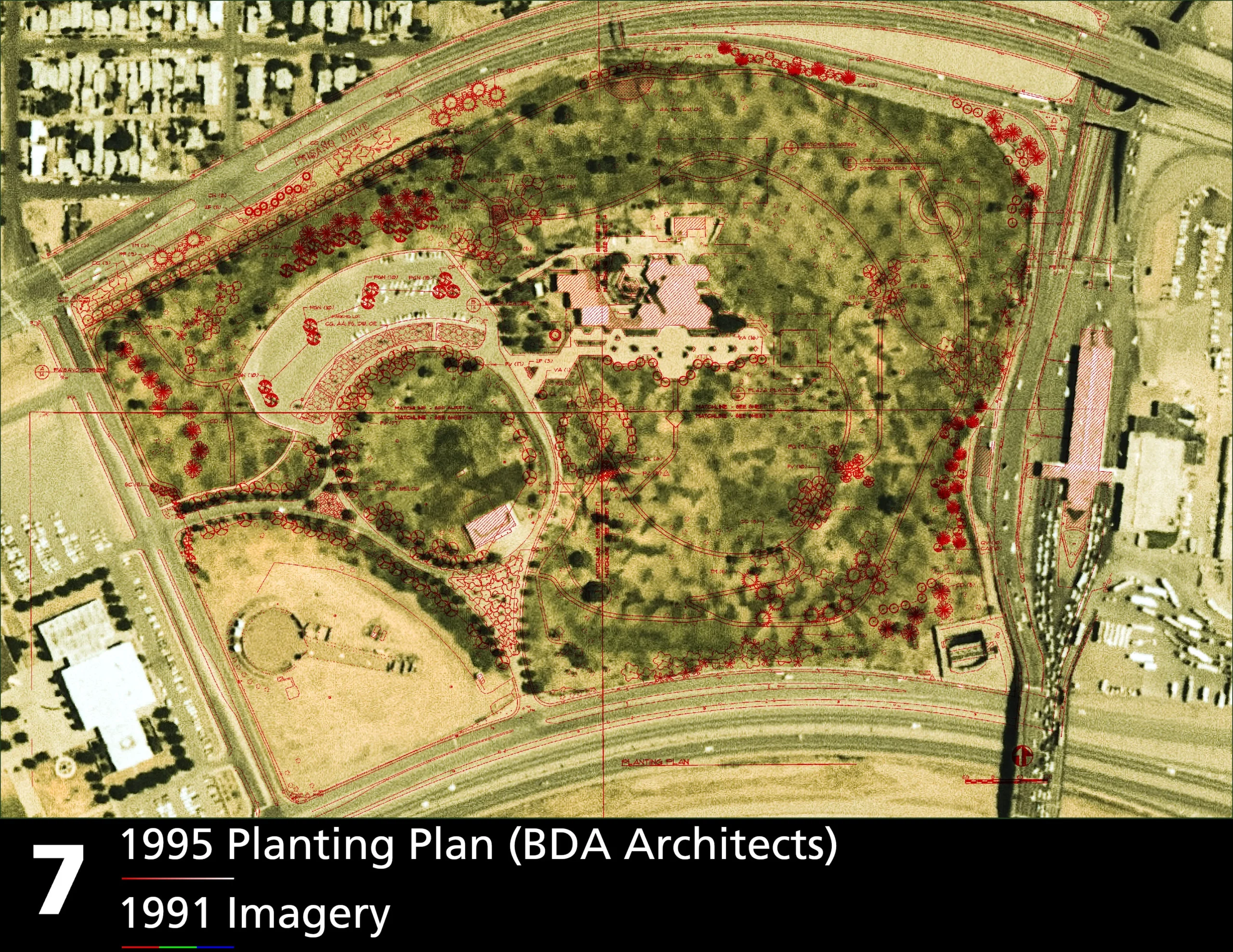
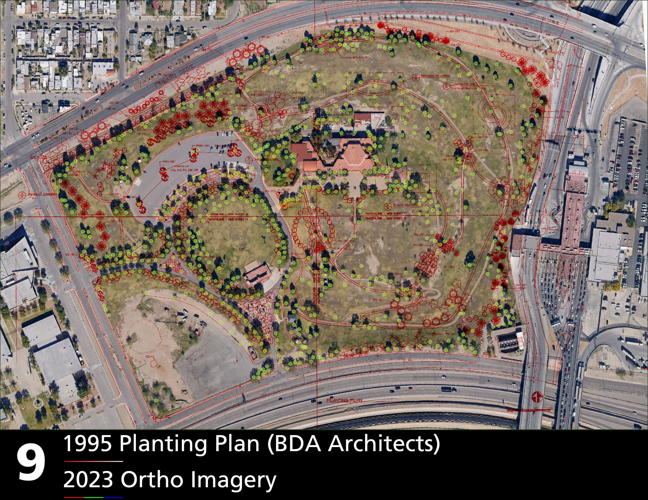
Although Chamizal National Memorial is automatically listed on the National Register of Historic Places due to its congressional designation, no formal nomination had ever been completed. As part of the Cultural Landscapes Program, our team was tasked with laying the groundwork for a full nomination—placing particular emphasis on the designed landscape as a key element of the site’s historical significance.
Archival Research & Site History Development
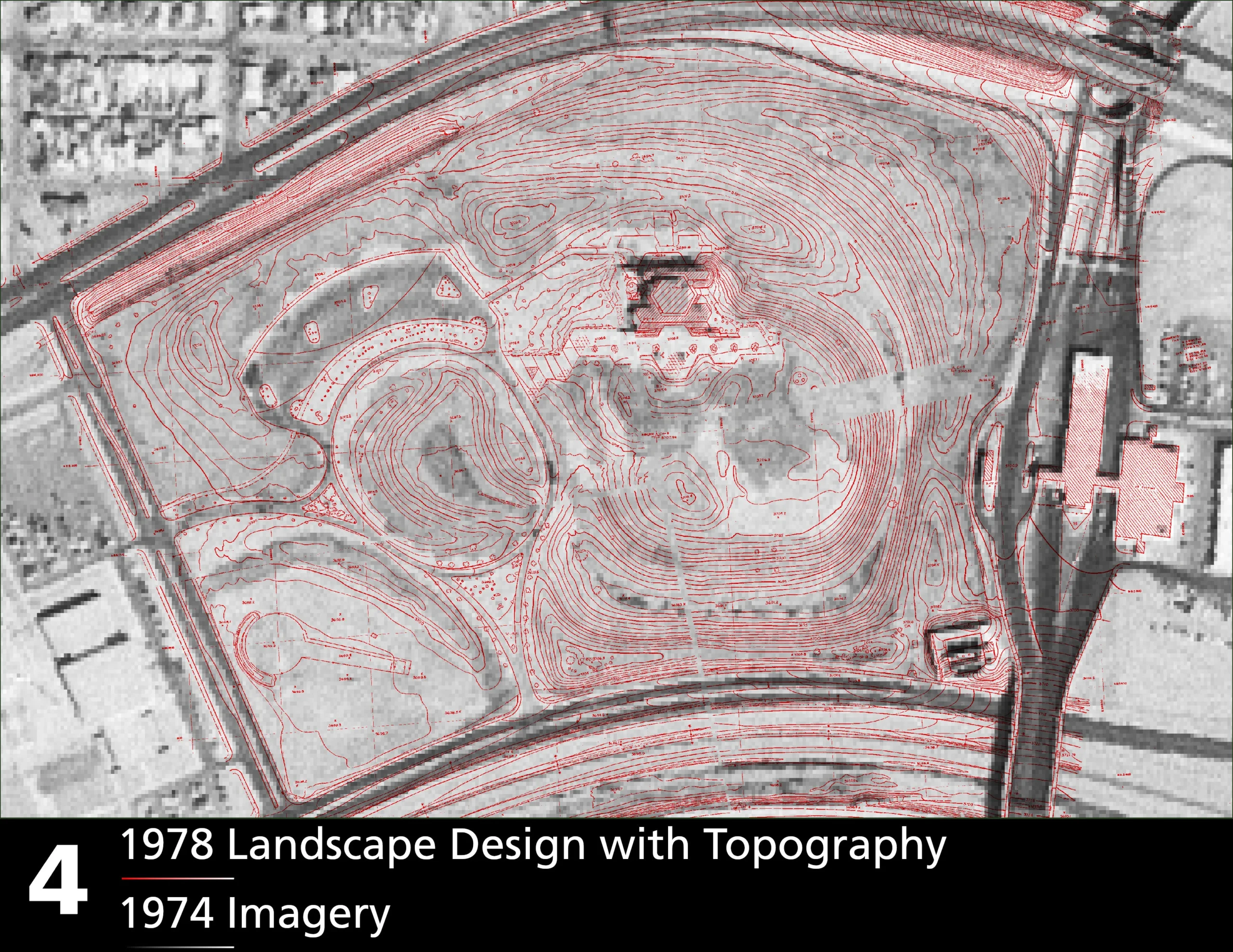
To support this effort, I conducted extensive archival research—reviewing planning documents, oral histories, architectural drawings, and historic aerial imagery. This work helped articulate a site history that foregrounds the intentional landscape design as central to the memorial’s character and meaning.
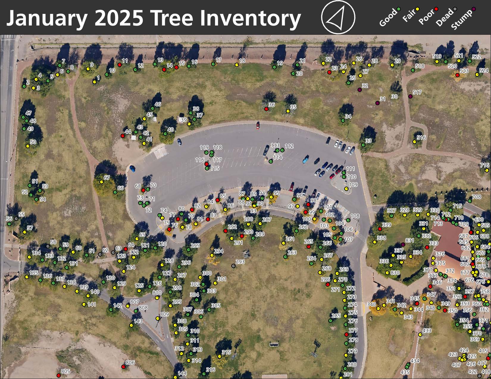
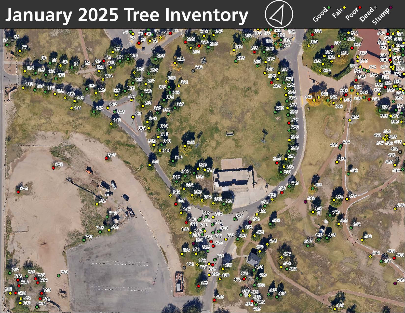
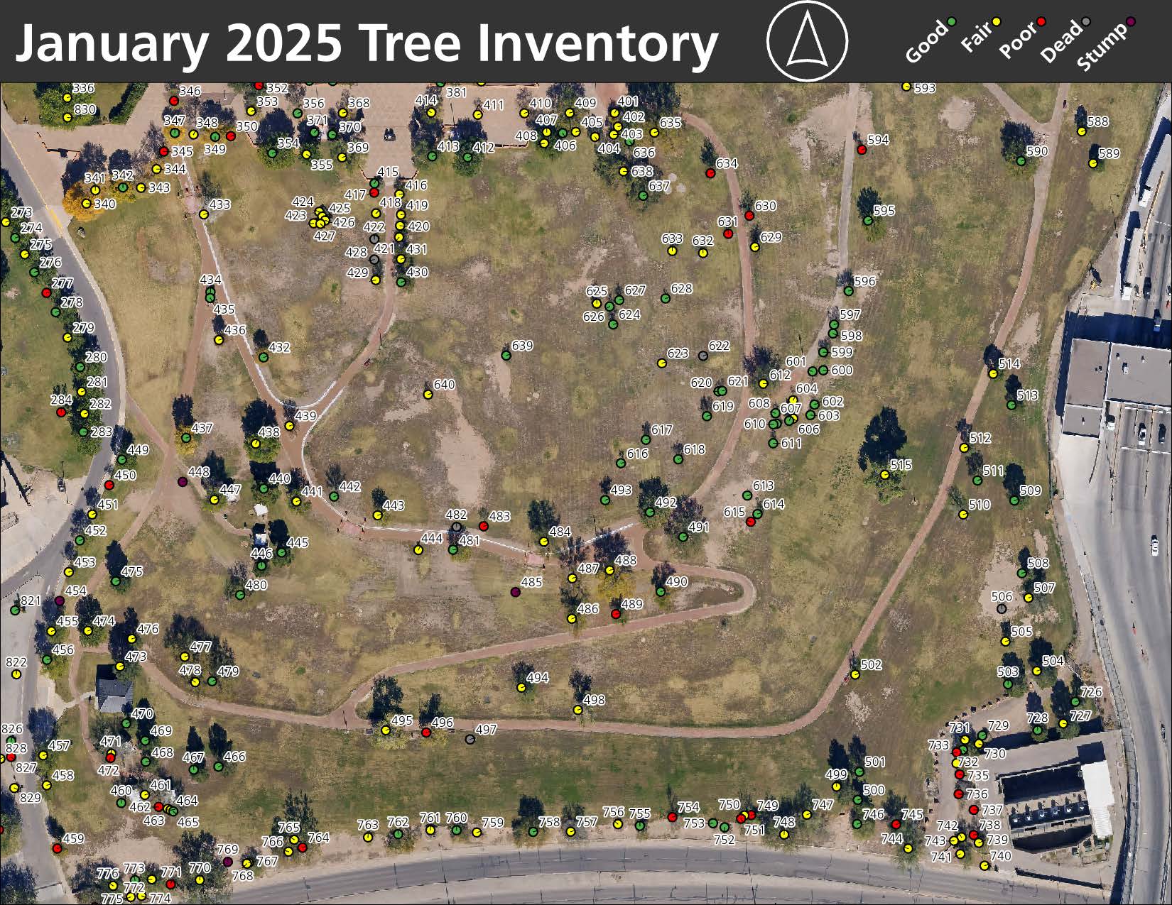
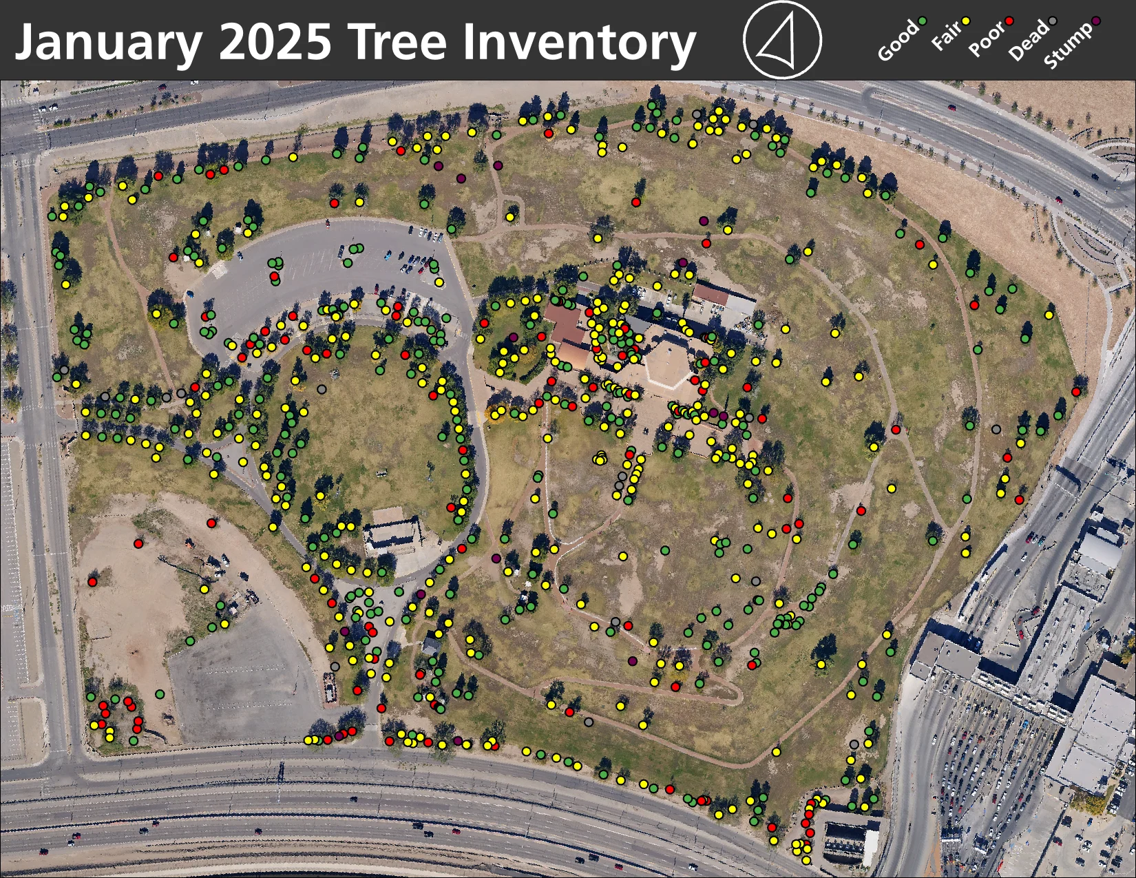
Geospatial Documentation & Tree Inventory
During our site visit, I aligned and refined existing GIS data, relating it to cultural resource management frameworks to ensure we had sufficient baseline documentation for future preservation efforts. We also conducted a tree inventory and condition assessment to support landscape maintenance planning.
Supporting Immediate Park Needs
Coinciding with our visit, the park’s landscape team was preparing a new tree maintenance contract. To ensure they had actionable, up-to-date data, I produced detailed paper maps alongside our standard digital deliverables (web maps and geodatabases), enabling park staff to work effectively with contractors to preserve the landscape’s character and extend the life of mature trees.