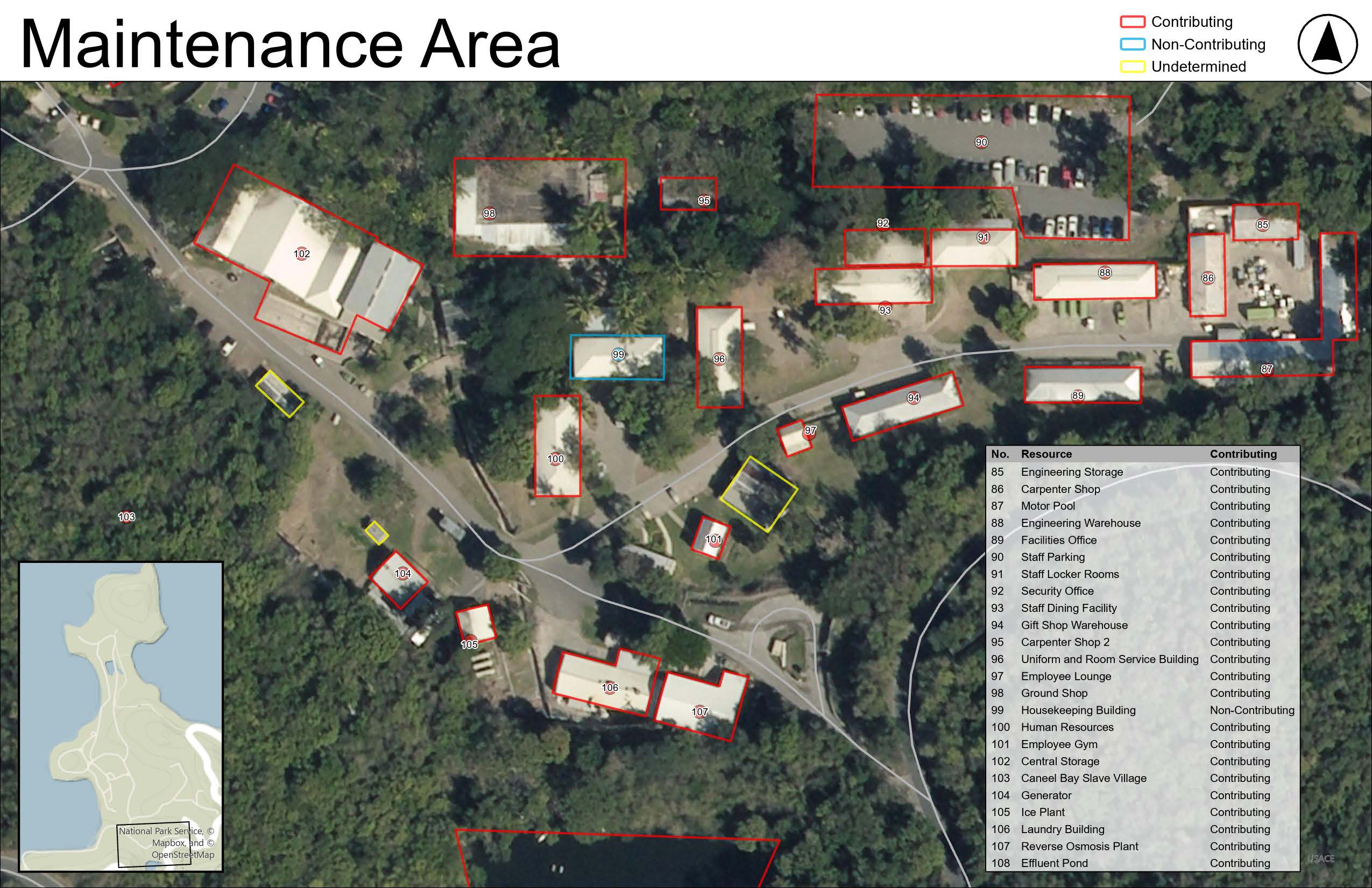
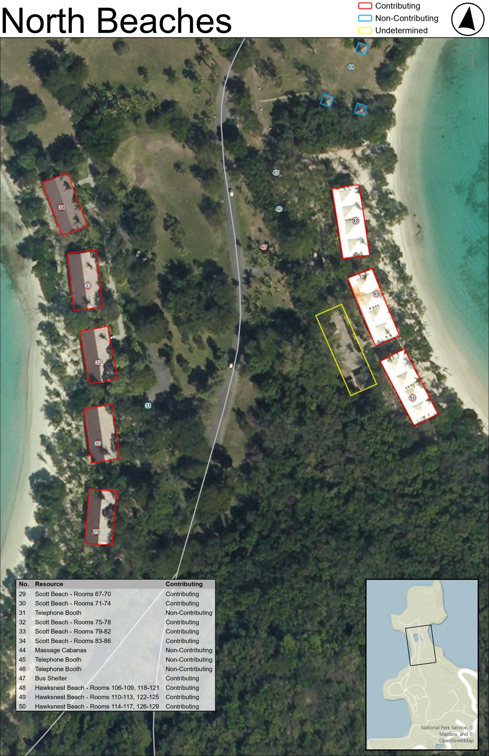
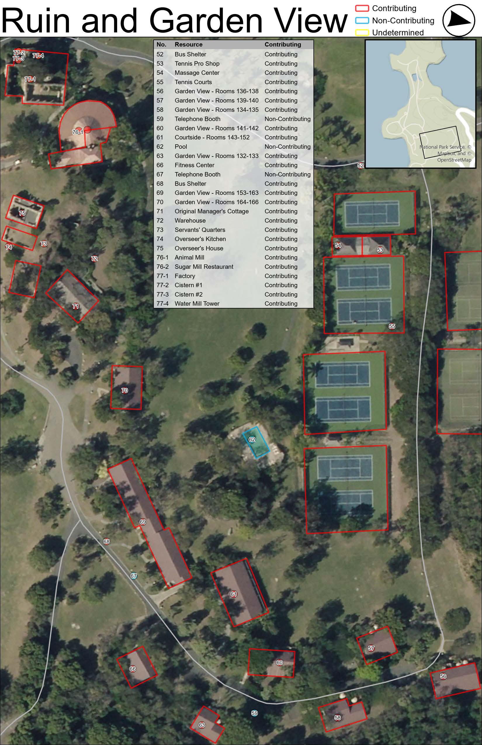
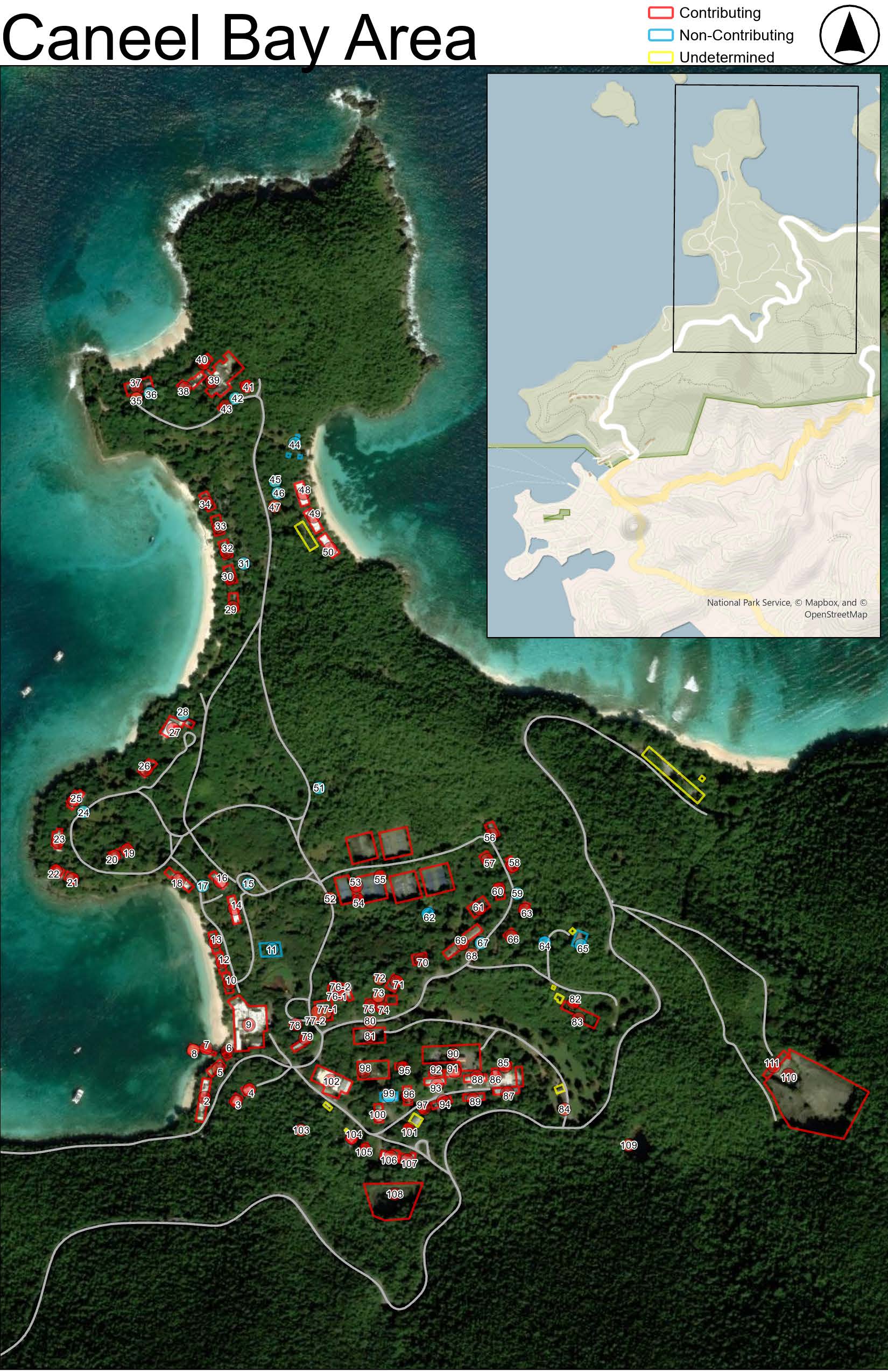
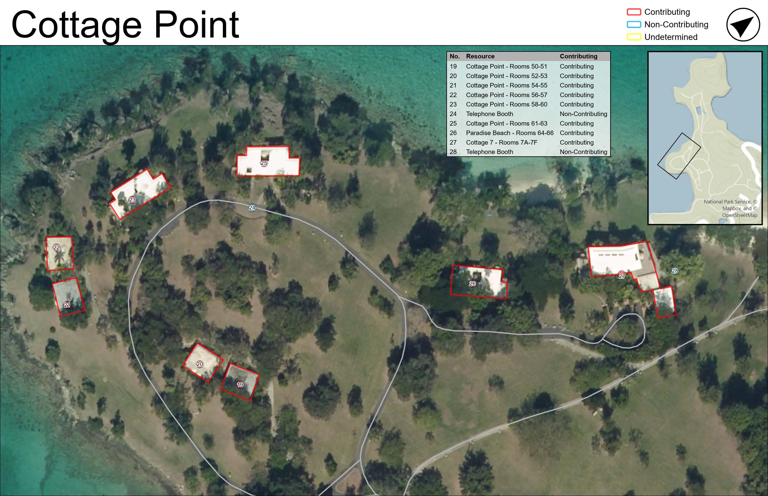
In early 2025, I supported a rapid cultural resource assessment of the former Caneel Bay Resort at Virgin Islands National Park. With the site heavily damaged and overgrown following two major hurricanes in 2017, I developed Field Maps tools, web layers, and paper maps, integrated archival materials throughout our visit, and coordinated daily with a small field team to inventory hundreds of historic features—laying the groundwork for future preservation planning in a challenging, post-disaster context.
Post-Storm Cultural Resource Assessment
With limited prior access and significant site degradation, we knew entering a confusing and overgrown environment was inevitable. Preparation, in the form of clear sectioned maps and rich web layers, and adaptability, in nightly reviews and updates of our findings, were key to our success.
Geospatial & Archival Integration
I developed web map layers to incorporate previous evaluations and orient our team, and created sectioned paper maps to support field navigation and data collection. Upon gaining access to the archives mid-trip, I scanned and georeferenced as-built drawings nightly to clarify the resort’s original layout and assess integrity in the field. This archival information proved essential in identifying lost circulation paths and historic structures obscured by bramble.
Field Coordination & Rapid Inventory
With a small team of six, maintaining daily coordination was critical. We worked closely with subject matter experts to inventory hundreds of features, relying on a combination of GIS tools, historic aerials, and physical documentation to make sense of a highly altered landscape.