As part of my GIS Certificate capstone, I collaborated with the Idaho BLM to build an interactive wildfire planning tool aligned with Potential Operational Delineations (PODs). I led raster analysis using LANDFIRE data, georeferenced NEPA project areas, developed a dashboard for cross-jurisdictional planning, and created automated tools and detailed documentation to support long-term agency use and adaptation.
GIS Capstone Project (2024)
As part of my GIS Certificate program at the University of Washington, I partnered with the Idaho BLM’s Cottonwood and Coeur d’Alene offices to support wildfire planning efforts. I led the development of a dashboard integrating Potential Operational Delineations (PODs), planning units defined by natural control features rather than administrative boundaries, with LANDFIRE raster datasets.
Raster Analysis & Dashboard Development
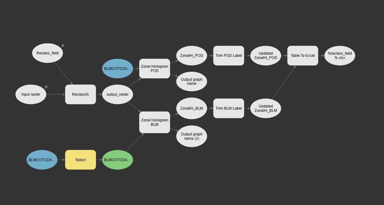
I performed raster-based zonal analyses to determine dominant fire regimes, vegetation types, and succession classes within each POD. These outputs were paired with digitized NEPA project areas to support cross-jurisdictional planning. I built custom tools in ArcGIS Pro ModelBuilder to automate these processes for future use.
Client Collaboration & Technical Documentation
Working closely with the BLM, I clarified user needs, coordinated a small team, and adapted the dashboard to meet real-world constraints, including system friction within ESRI’s Experience Builder and cross-organization data sharing limitations. To future-proof the tool, I authored detailed technical documentation and ensured all deliverables could be maintained independently by agency staff.